Acoustic Imaging
A side-scan sonar imaging platform.

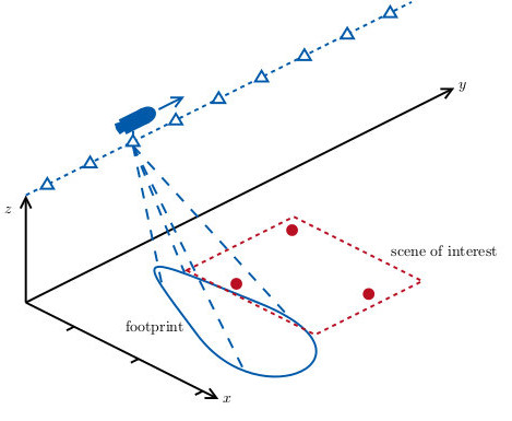
Sonar (sound navigation and ranging) systems use sound propagation to navigate underwater or to detect man-made or natural objects by estimating range and angle of arrival of backscattered sound waves. Moreover, side-scan or side-looking sonar systems are used to construct images of the underwater environment which is used, for example, in exploration missions.

The Signal Processing Group closely collaborates with an industry partner who provides experimental data from exploration missions. The Signal Processing Group also collects data from on-site laboratory.

Our main research interests in the field of acoustic imaging technology cover the following areas:

Automatic detection and classification of underwater objects, image reconstruction and compensation of navigation errors, trajectory estimation for underwater vehicles, direction-of-arrival estimation, sparse signal processing and compressed sensing.

For more information on Acoustic Imaging please see the sections below or contact the respective research associates.

Projects

Underwater vehicles, equipped with suitable transceiver elements, can be used for synthetic aperture imaging (SAI). SAI achieves a range-independent resolution used for high-quality sonar imagery. However, this technique requires precise knowledge of the positions of transmitter and receiver elements. Hence, it is important to obtain accurate estimates of the imaging platform trajectory. Received echo data is used to estimate the vehicle motion. This technique is termed micronavigation.

The aim of this project is to improve the image quality in synthetic imaging sonar ground-range imaging. The resulting high-quality images are fed into an automated detection and classification system for object recognition.

When the seafloor has a strongly varying topography or in the case of non-linear trajectories, the images strongly suffer from defocussing effects which have to be compensated for by developing a suitable signal processing chain. Reliable estimates of the seafloor topography are obtained in order to include height information in the motion estimates. This information is used during image reconstruction, yielding significant improvements in image quality.

For more information on this research project please contact Abdelhak Zoubir .

Passive sonar systems can be used for exploration missions and to improve navigation of underwater vehicles. The received signals can be further used to identify the source of the received signals. This is especially challenging since the received sonar signals exhibit a wide bandwidth and suffer from very low signal-to-noise ratios.

The aim of this study is an investigation of sparse signal processing methods in order to achieve improved accuracy of the direction-of-arrival estimates as well as higher resolution in terms of source separation. Sparse acquisition in along-track direction can be further used to speed up the collection of data.

An underwater vehicle, equipped with hydrophone arrays, receives acoustic signals from the environment. These signals contain useful information of the environment such as angle-of-arrival, distance and source power which can be extracted.

For more information on this research project please contact .